


City of Dubuque leaders seek to develop a traffic efficiency program that local officials say will be the first of its kind in the country.
Dubuque City Council members this week unanimously agreed to initiate a request for proposals process to design and implement a Smart Traffic Routing with Efficient and Effective Traffic System, also known as STREETS.
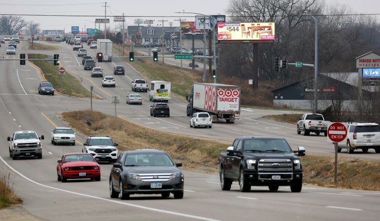
The system will use analytics data from cameras and sensors placed throughout the Dubuque metropolitan area to manage and reroute traffic in real time to improve efficiency on Dubuque roadways.
Chandra Ravada, director of transportation and planning for the East Central Intergovernmental Association, said the system will be the first of its kind nationally.
“It’s been done on the corridor level in larger cities, but we will be the first in the country to do a system for the whole metropolitan area,” he said.
David Ness, a city civil engineer, said the STREETS program is only possible because of the city’s already complex and ubiquitous network of traffic information gathering equipment, such as intersection cameras, speed tracking devices and sensors designed to track the routes of unique cell phone signals.
Information from those devices has been used previously to analyze and implement new traffic policies, Ness said. With the STREETS program, the information can be used to adjust the timing of signal lights or to divert traffic after an accident occurs in real time.
“We have the communications backbone that makes this project possible,” Ness said. “We were bringing in all this data, but we were never using it to its full potential. That will change with this new system.”
For drivers, that means traffic will move more quickly on average. Congestion-creating incidents, such as crashes, will be addressed more quickly, with traffic diverted to the most optimum alternative route.
Eventually, drivers will receive notifications from programs already on their phones, such as Google Maps, indicating the most optimal route to reach their destination, Ness said. While third party apps will deliver the notification, the city’s STREETS system will provide the ideal route.
“We could create our own app, but it’s unlikely many people would download it,” Ness said. “This way, we can deliver those messages through apps that people are already using.”
The system has received interest from the state and federal government, both of which are contributing funds to the project’s $3.7 million price tag. Funding so far includes a $1 million Federal Highway Administration grant, about $1.2 million in state funds and $700,000 from the Dubuque Metropolitan Area Transportation Study Transportation Improvement Program.
The city is currently responsible for funding $575,000 of the project.
Ravada said that while the project has momentum, it is still multiple years from becoming operational. After a contract is awarded by the city for the creation of the system, the actual development of the program would take 24 to 30 months to complete.
Ravada said he estimates the program will go live by the middle of 2023 and will initially only manage 33 of the city’s 115 intersections, most of which will be located on Dubuque’s West End.
City Council Member Danny Sprank said he believes that if the system is successful, Dubuque will pave the way for other municipalities throughout the country to use the same program for their streets.
“It’s a really interesting program,” he said. “Once it is all complete and working, a lot of other cities will be interested in it.”